  Zion National Park Hiking Zion National Park Hiking
This Zion National Park hiking guide was written and compiled by
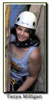
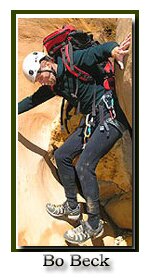
and Mary Cisneros. Bo is the veteran on Zion's elite high angle search and rescue team and knows the park as well as anyone. He was canyoneering in the park long before the term was used. He still calls it "hiking with a rope" rather than canyoneering. Bo has served on the SAR team since 1996 and when he has time he is a lead instructor for Paragaon Climbing School. For six years Bo and I wrote monthly hiking articles for local magazines including Today in Dixie and St. George Today and spent every weekend, almost without fail, hiking, canyoneering or climbing together in Zion and the nearby areas that are covered on this site. We have just finished our first hiking book which should be on the shelves by Summer of 2011.
Zion Peak Bagging- If you like getting to the top of things, then peak bagging might be your bag. Bo and I team up with Courtney and explore some of Zion's recently unpublished peaks.
 If you're thinking of joining today's world of canyoneering, be ready to lug a wetsuit up steep mountains, swim in dirty-ice cold water, climb up and down boulders, scale slick rocks and learn the technical skills and rope work required for rappelling and getting yourself through a canyon. If you're thinking of joining today's world of canyoneering, be ready to lug a wetsuit up steep mountains, swim in dirty-ice cold water, climb up and down boulders, scale slick rocks and learn the technical skills and rope work required for rappelling and getting yourself through a canyon.
Kolob Hiking - There are two sections of the park called Kolob, one by Cedar City referred to as Kolob Fingers or Kolob Canyons, and another near the small town of Virgin called the Kolob Terrace.
Backpacking in Zion National Park - Backpacking can be found in all three sections of the park. The most popular are Zion's East and West Rims.
Most Popular Trails - See our vacation planning section for suggested classic hiking trails. For the more adventurous take a look a Bo and Tanya's favorite trails in Zion.
We also offer a chart of routes and trails just in Zion Canyon or another of those outside of Zion Canyon.
Zion Canyon Hiking - Hiking East Zion
Suggested Hiking Gear: A sturdy pair of shoes are recommend for many of the trails in Zion National Park. Many quality shoes will help grip the rocks and prevent injury.
| Classic Zion National Park Trails |
|
Trail or Route
|
miles
round trip
|
Ascent
Descent
|
Average
Time
|
Location
|
Kids
Bikes
Accessible
|
Difficulty
|
Notes
|
|
Canyon Overlook
|
1
|
+163'
|
1 hr
|
Hwy 9
|
Kids
|
Easy
|
Classic
|
|
Weeping Rock
|
.5
|
+98'
|
.5
|
Canyon
|
Kids
|
Easy
|
Classic
|
|
Riverside Walk
|
2
|
+69'
|
1
|
Canyon
|
K, A
|
Easy
|
Classic
|
|
Lower Emerald Pools
|
1.2
|
+69'
|
1
|
Canyon
|
K, A
|
Easy
|
Classic
|
|
Grotto Trail
|
.5
|
+20'
|
.5
|
Canyon
|
K, A
|
Easy
|
Classic
|
|
Pa'rus Trail
|
3.5
|
+50'
|
2
|
South
|
K, A, B
|
Easy
|
Classic
|
|
Middle Emerald Pool
|
2
|
+150'
|
2
|
Canyon
|
Kids
|
Moderate
|
Classic
|
|
Kayenta Trail
|
2
|
+150'
|
2
|
Canyon
|
Kids
|
Moderate
|
Classic
|
|
Watchman
|
2
|
+456'
|
2
|
South
|
Kids
|
Moderate
|
Classic
|
|
Upper Emerald Pool
|
3
|
+350'
|
1
|
Canyon
|
Kids
|
Moderate
|
Classic
|
|
Sand Bench
|
3.4
|
+907'
|
2
|
Canyon
|
Horses
|
Moderate
|
Classic
|
|
Hidden Canyon
|
2
|
+850'
|
3
|
Canyon
|
Strenuous
Steep
Cliff-Side
|
Classic
|
|
Observation Point
|
8
|
+2148'
|
5
|
Canyon
|
Classic
|
West Rim to
Scouts Lookout
|
4
|
+1050'
|
4
|
Canyon
|
Classic
|
|
Angels Landing
|
5
|
+1488'
|
5
|
Canyon
|
Classic
|
West Rim to
Cabin Spring
|
10
|
+2400'
|
6
|
Canyon
|
Classic
|
|
East Rim
|
10
|
+/-4400'
|
6
|
Hwy 9
|
Classic
|
|
Zion Narrows
|
12
|
-1410'
|
13
|
Canyon
|
Water Hiking
|
Classic
|
|
Routes in and on the edge of Zion, listed in order of difficulty.
Routes are trails that are not maintained or are off the beaten path. Route finding skills are needed and few, if any people, are usually seen along these routes. A moderate or strenuous route
is far more difficult than a moderate or strenuous trail.
Do not attempt routes beyond your skills.
Do not wear inappropriate foot wear on rock!
Remember! YOUR safety is always YOUR responsibility!
|
|
Tunnel Canyon
|
1.6
|
+300
|
1
|
Hwy 9
|
Kids
|
Easy
|
Spring
|
|
Cascading Falls
|
2
|
+650
|
2
|
Hwy 9
|
Kids
|
Easy
|
Spring
|
|
Two Pines Arch
|
.81
|
+400
|
2
|
Hwy 9
|
Boulders
|
Moderate
|
Arch
|
|
Shelf Canyon
|
2
|
+100
|
2
|
Hwy 9
|
Boulders
|
Moderate
|
Slot
|
|
Separation Canyon
|
2.5
|
+400
|
2
|
Hwy 9
|
Kids
|
Moderate
|
Spring
|
|
Pine Creek Waterfall
|
.25
|
+200
|
1
|
Hwy 9
|
Boulders
|
Moderate
|
Fun
|
|
Middle Pine Creek
|
2
|
+200
|
2
|
Hwy 9
|
Boulders
|
Moderate
|
Fun
|
|
Many Pools
|
1
|
+1442
|
2
|
Hwy 9
|
Kids
|
Moderate
|
Spring
|
|
Hidden Gardens
|
2
|
|
2
|
Hwy 9
|
Kids
|
Moderate
|
Slot
|
|
Hidden Arch
|
2
|
+200
|
2
|
Hwy 9
|
Kids
|
Moderate
|
Arch
|
|
Clear Creek
|
2
|
|
2
|
Hwy 9
|
Kids
|
Moderate
|
Slot
|
|
Gifford Canyon
|
3
|
+200
|
2
|
Hwy 9
|
Boulders
|
Moderate
|
Wash
|
|
Checkerboard Arch
|
4
|
+270
|
5
|
Hwy 9
|
Kids
|
Moderate
|
Arch
|
|
Jug Handle Arch
|
2.4
|
+650
|
4
|
Hwy 9
|
Boulders
|
Moderate
|
Arch
|
|
Eagle Crags
|
4.8
|
+650
|
4
|
South
|
Horse,K
|
Moderate
|
BLM
|
|
Huber Wash
|
4
|
+310
|
3
|
South
|
Horse,K
|
Moderate
|
Winter
|
|
Scoggins Wash
|
11
|
+934
|
9
|
South
|
Horse
|
Moderate
|
Winter
|
|
Coalpits Wash
|
14
|
+834
|
9
|
South
|
Horse
|
Moderate
|
Winter
|
|
Chinle Trail
|
16.4
|
+50
|
10
|
South
|
Horse
|
Moderate
|
Winter
|
|
Deertrap Mountain
|
20
|
+1170
|
10
|
Hwy 9
|
East Rim
|
Strenuous
|
View
|
|
Cable Mountain
|
16
|
+1048
|
10
|
Hwy 9
|
East Rim
|
Strenuous
|
View
|
|
Checkerboard Mesa
|
2
|
+600
|
4
|
Hwy 9
|
Scrambling
|
Strenuous
|
Summit
|
|
Echo Canyon
|
8
|
+700
|
5
|
Canyon
|
Boulders
|
Slot
|
Slot
|
|
East Temple
|
2.25
|
+1100
|
4
|
Hwy 9
|
Scrambling
|
Strenuous
|
View
|
|
Progeny Peak
|
1.2
|
+1075
|
3
|
Hwy 9
|
Scrambling
|
Strenuous
|
Summit
|
|
Spry Canyon
|
2
|
+700
-1050
|
6
|
Hwy 9
|
Scrambling
|
Strenuous
|
Petroglyphs
|
|
Cockeye Falls
|
4.5
|
+/-925
|
6
|
Hwy 9
|
Scrambling
|
Strenuous
|
View
|
|
Parunuweap Pass
|
5.2
|
+1150
|
8
|
Hwy 9
|
Scrambling
|
Strenuous
|
View
|
East Fork
Virgin River
|
8.6
|
+/-1650
|
10
|
Hwy 9
|
Scrambling
|
Route Finding! Very Strenuous
|
Slot
Powell Plaque
|
|
Mt. Kinesava
|
2.5
|
+2812
|
2.5
|
South
|
Scrambling
|
Route Finding! Very Strenuous
|
Petroglyphs
|
|
Mountain of the Sun
|
7
|
+1526
|
10
|
Canyon
|
Scrambling
|
Route Finding! Very Strenuous
|
Summit
|
|
Bridge Mountain
|
10
|
+1056
|
16
|
Hwy 9
|
Scrambling
|
Route Finding! Very Strenuous
|
Arch
|
|
Lady Mountain
|
1.3
|
+2440
|
8
|
Canyon
|
Scrambling
|
Route Finding! Very Strenuous
|
Summit
View!
|
Mineral Gulch
Meadow Creek
|
19
|
+1100
-4400
|
19
|
Hwy 9
|
Scrambling
|
Route Finding! Very Strenuous
|
Slot
|
|
Technical Hiking and Canyoneering
|
|
Zion's Peak Bagging
|
Route Finding
Technical
|
Summit
|
|
|
Route Finding
Technical
|
Canyons
|
|
More Hiking in and Near Zion National Park
|
|
Kolob Hiking
|
Various
|
|
Winter Hiking
|
Various
|
|
Hiking to Water
|
Various
|
|
Backpacking in Zion
|
Overnight
|
|
Greater Zion Area
|
Various
|
|
|
[South of Zion's South Entrance] [Cliff-side: Exposed scramble or ledge] [Slot: Slot or Narrows]
[Boulders: Climbing over boulders or up steep slabs] [Semi-Tech: Rope and climbing skills]
[ Scrambling: Hiking/Climbing up or down steep slick rock]
[Technical: Advanced climbing or canyoneering]
Disclaimer and Privacy Policy
All rights reserved and Copyright by Zion National - Park dot com
Do not use photos or maps without permission from Zion National - Park dot com
|
|
East side of Zion
The east side of Zion National Park is slickrock country. Slickrock is red sandstone that is lacking large concentrations of iron oxide. Thus these are the more easily eroded rock forms, buttes and domes. The rock does not appear slick. In fact, it is rough and has a loose layer of sand on the surface. The rock formations on the east side of Zion are spectacular, but most of the well known front country trails are located in Zion Canyon.
|


