|
|
 |
|||
|
Zion National Park Lodging Park Info Vacation Weather Photos Hike SR-9 Slots Backpack Camping |
||||

|
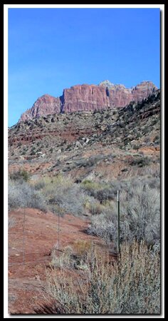
Huber Wash Huber Wash located on the high desert of southern Zion National Park , is an easy hike that can be done in the winter when many of Zion's other trails are closed due to ice and snow. Petrified-wood, can be found in select areas of this hike, including at the end of the trail. Keep in mind that you are in a National Park and collecting anything like this is forbidden by the NPS.
 Cryptobiotic soil Cryptobiotic soilCryptobiotic soil is one of the oldest living forms of life. If damaged it can take several decades to repair itself. The crusty ground cover is made up of mostly cyanobacteria, but algae, lichens, moss, bacteria and microfungi are also involved in the makeup. Long ago these were responsible for changing the earths original atmosphere one that is filled with life sustaining oxygen.
Continue upstream, staying in the main wash. Do not wander out of the wash, to avoid damaging delicate cryptobiotic soil. Look for petrified wood throughout this hike, however scavengers have stolen most of the small pieces. After an easy 2- mile hike the wash ends in an alcove or dryfall. At times there is a nice waterfall in the alcove, but there is always a nice display of vegetation growing in the alcove. In the winter there can be icicles hanging on the sides. Be sure to look for the petrified log-jam on the right side of the wash. Options: Exploration of the Chinle Trail , Coalpits Scoggins or Huber Wash. Beta: Coordinates and other trail and canyoneering information by Zion Park search and rescue veteran team member Bo Beck and zionnational-park.com author Mary Cisneros. To post trip reports, offer corrections, updates, or for more information please visit the Zion National Park Forum Suggested Gear: A sturdy pair of shoes are recommend to hike the trails in Zion National Park. Many quality shoes will help grip the rocks and prevent injury.
Zion National Park, UtahHistory of the Thunderbird |
East Zion Lodge Mileage from Stay in a hotel the heart of the parks, Mount Carmel Junction, and visit the treasures of the Southwest and Utah. Site Map Zion Hiking |
||||||||||||
|
This is my new favorite quote:
"I don't know who Mary Cisneros is, but I mean zionnational-park.com It's a better site than the NPS's anyway." Written by the authors of the book: Favorite Hikes in and around Zion National Park |
|||||||||||||


|
Zion History |
|---|
All rights reserved © Copyright Zion National-Park dot com
Do not use text, photos or maps without permission © Zion National-Park dot com
Contact the Author Mary Cisneros with any errors