|
||||
|
Zion National Park Lodging Park Info Vacation Weather Photos Hike SR-9 Slots Backpack Camping |
||||
|
Checkerboard Mesa hike Checkerboard Mesa at a Glance
Parking - Drive to the east entrance of the park where you will find the Checkerboard Mesa pullout and view point, just east of the toll booth. Walk west along Highway 9 until you are at the base of Checkerboard Mesa. GPS Coordinates WGS84 Datum Parking 37°13.530 N 112°52.807 W
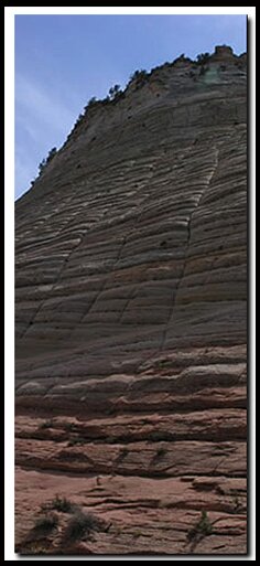
The Wash - Follow the drainage on the east side of the mesa that runs along the slickrock, bypassing several potholes. Before too long the path becomes a sandy wash, winding southerly and ascending to the saddle that separates the more popular area north of Highway 9 from the less visited plateaus above Parunuweap. Stay in the wash as much as possible, passing the social trails that split off to the left, heading into the shrubbery on the hillside above. You will find the travel easier if you stay against the mountain and your hike will result in less erosion to the hillsides on either side of the drainage. There will be a few dry-falls along the route that can usually be avoided by going left, up and then around. The ascent will increase as the top of the saddle becomes more obvious. Watch for a visible trail that emerges and ascends through the trees. This "trail" will take you out of the drainage where you need to then locate the path which branches to the right before it reaches the actual saddle highpoint. The path demands that you scramble up a short 8-foot cliff band. Soon you will come to the forested ledge just below, and east of the Checkerboard Mesa tabletop. Now it is necessary to switch direction and travel north, back toward Highway 9, hiking on top of the ledge. Stay to the right, and just above the developing cliff so that you avoid even denser foliage up high. The use of game trails will make travel easier.This way is simpler than trying to ascend to the base of the caprock that comprises the Checkerboard Mesa table-top. Continue north for several hundred yards to the promontory just north and below the actual tabletop. Soon the terrain will level out and spectacular views appear. There is a good flat area to sit and have lunch. After lunch walk around and marvel at the expansive views of slickrock country. Options: Checkerboard Arch The main route to Checkerboard Arch is also part of one entrance to the magnificent Parunuweap Canyon route that leads through Fat Man's Misery and to the East Fork of the Virgin River. Freestanding Arches in Zion National Park GPS coordinates are only references and may or may not be accurate. Do not rely on GPS coordinates Beta: Coordinates and other trail and canyoneering information by Zion Park search and rescue veteran team member Bo Beck and zionnational-park.com author Mary Cisneros. To post trip reports, offer corrections, updates, or for more information please visit the Zion National Park Forum Suggested Gear: A sturdy pair of shoes are recommend to hike the trails in Zion National Park. Many quality shoes will help grip the rocks and prevent injury.
Zion National Park, UtahHistory of the Thunderbird |
East Zion Lodge Mileage from Stay in a hotel the heart of the parks, Mount Carmel Junction, and visit the treasures of the Southwest and Utah. Site Map Zion Hiking |
||||||||||||
|
This is my new favorite quote:
"I don't know who Mary Cisneros is, but I mean zionnational-park.com It's a better site than the NPS's anyway." Written by the authors of the book: Favorite Hikes in and around Zion National Park |
|||||||||||||
|
Zion History |
|---|
All rights reserved © Copyright Zion National-Park dot com
Do not use text, photos or maps without permission © Zion National-Park dot com
Contact the Author Mary Cisneros with any errors


 as the sole method of navigation. Always have an accurate, detailed map at hand and have the proper map reading and navigation skills before setting out on any hike. Many of the hikes listed in this guide travel into canyons where a GPS has limited capabilities. Always check your position with a detailed map before dropping into a canyon.