 |
||||
|
Zion National Park Lodging Park Info Vacation Weather Photos Hike SR-9 Slots Backpack Camping |
||||
Meadow Creek to Mineral GulchMeadow Creek and Mineral Gulch offer the hiker a variety of terrain, natural features and archaeological viewing with the feeling of total isolation. Most of the hiking is done on BLM land, however some private property is crossed during this hike. Please be respectful and remove any trash found and leave only footprints. The hiking is mostly easy wash walking, however there may be steep scrambling involved depending on the course taken. The easiest route is to drop into Meadow Creek from Highway 9 (not where Meadow Creek passes under Highway 9, but just to the west), and bypassing the two waterfalls downstream. A secondary option is to park at Mineral Gulch where it passes under Highway 9, entering private property and skirting on the southeastern rim until a weakness allows entry into Mineral Gulch several miles downstream. Total hiking distance for either route to the petroglyphs, near the East Fork of the Virgin River, and back is 14 to 16 miles. The Meadow Creek out and back is 16 miles (add 3 miles for the side trip to 7 Arch). After hiking Meadow Creek to Mineral Gulch and the caves and petroglyphs an optional exit up 7 Arch Canyon and out to the Mineral Gulch parking area can be done. This would shorten the 16 mile hike trip by 2 miles, however this would require a car spot.
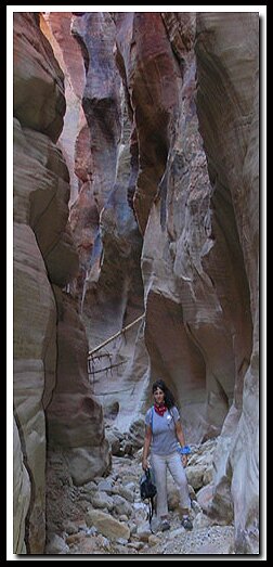
Mineral Gulch - The confluence with Mineral Gulch is quite evident as it enters from the left. Follow Mineral Gulch downstream and after a mile or so the walls close in and present some stunning Slot Canyon hiking. At 7 miles into the hike look for a cave on the left, just above the canyon floor. Along the ledge are several caves that may have been used as shelter by ancient civilizations and just across the wash and slightly upstream are some nice petroglyphs. Parunuweap - If energy levels are high, it's less than a half-mile downstream to the Mineral Gulch and the East Fork of the Virgin River confluence. This is Parunuweap. Remember that the hike out is still ahead so watch your time. Seven Canyon - On the hike out if time and energy permits, just a short distance up "Mineral Gulch" from the confluence with "Meadow Creek" is another canyon called Seven Canyon, which enters from the left. It was given it's name because the arch itself looks like the number "7". A short hike up this canyon displays some faded petroglyphs which are located on the left, under a large blind arch. Further up this canyon (.75 miles) and at its abrupt ending at a headwall is the Seven Arch. Exit - If a vehicle has been left at the Mineral Gulch parking area, it is possible to scramble up a ramp just before the headwall and then from the top follow a wash (right hand wash) until it meets a road and follow it back to where the dirt road intersects with Highway 9, just a short distance west of the parking area. If this choice is made, don't leave ropes at the waterfalls in Meadow Creek. If you choose to hike back out the way entered, leave in time that you have plenty of daylight as the exit up the hillside to the vehicle can be easily missed. We do not recommend the hike down the eastern rim of Mineral Gulch as it crosses private lands and the ramp into Mineral Gulch is steep and exposed in places. Options to explore in the area: Parunuweap - Includes Fat Man's Misery and exits at the Powell plaque. Parunuweap, but avoids the technical canyoneering section of Fat Man's Misery. Parunuweap with an exit at Elephant Butte. GPS Coordinates WGS84 Datum
Mineral Gulch Parking Twin Arches in Meadow Creek Caves and petroglyphs in Mineral Gulch Beta: Coordinates and other trail and canyoneering information by Zion Park search and rescue veteran team member Bo Beck and zionnational-park.com author Mary Cisneros. To post trip reports, offer corrections, updates, or for more information please visit the Zion National Park Forum Suggested Gear: A sturdy pair of shoes are recommend to hike the trails in Zion National Park. Many quality shoes will help grip the rocks and prevent injury.
Zion National Park, UtahHistory of the Thunderbird |
East Zion Lodge Mileage from Stay in a hotel the heart of the parks, Mount Carmel Junction, and visit the treasures of the Southwest and Utah. Site Map Zion Hiking |
||||||||||||
|
This is my new favorite quote:
"I don't know who Mary Cisneros is, but I mean zionnational-park.com It's a better site than the NPS's anyway." Written by the authors of the book: Favorite Hikes in and around Zion National Park |
|||||||||||||
|
Zion History |
|---|
All rights reserved © Copyright Zion National-Park dot com
Do not use text, photos or maps without permission © Zion National-Park dot com
Contact the Author Mary Cisneros with any errors


 Trail access: Highway 9 is open year-round. If it's dry this is a good cold weather hike, but once the ground gets wet from snow it's a slippery mess. This deters most hikers in the winter months.


 Meadow Creek Parking