 |
||||
|
Zion National Park Lodging Park Info Vacation Weather Photos Hike SR-9 Slots Backpack Camping |
||||
Hidden Arch
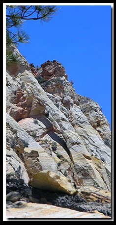
At a Glance Hidden Arch Walk up the creek bed for .3 mile until the dry stream bed turns northeasterly. A low angle slickrock wash enters from the left. Leave the creek bed and hike up the slickrock wash toward the mountain on the left, staying in the water course. After approximately .25 mile the path gets a little more difficult to follow. Leave the shallow wash and steer left toward the ridge top. There is some minor scrambling over the slickrock. Walk to the top of the hill and hike to the fallen tree. From that point examine the mountain to the right. The arch is high at the top and angled so it is not easy to see at first. Exit  Although Hidden Arch can be seen from Zion-Mt. Carmel highway, it was not discovered until a Zion National Park Ranger, Ron Kay, found it in 1998. Ron Kay is a seasonal ranger at the park and teaches at the Zion Field Institute. Although Hidden Arch can be seen from Zion-Mt. Carmel highway, it was not discovered until a Zion National Park Ranger, Ron Kay, found it in 1998. Ron Kay is a seasonal ranger at the park and teaches at the Zion Field Institute.
Best Trail features: The east side of Zion is characterized by slickrock and hoodoos with a few natural arches among its treasures. This arch is one of the two jug arches in the park. *Cryptobiotic soil is one of the oldest living forms of life. If damaged it can take several decades to repair itself. The crusty ground cover is made up of mostly cyanobacteria. Algae, lichens, moss, bacteria and microfungi are also involved in the makeup. Long ago these were responsible for changing the earths original atmosphere - one that is filled with life sustaining oxygen.
Checkerboard Mesa Viewpoint Hidden Arch Viewpoint: GPS coordinates are only references and may or may not be accurate. Do not rely on GPS coordinates as the sole method of navigation. Always have an accurate, detailed map at hand and have the proper map reading and navigation skills before setting out on any hike. Many of the hikes listed in this guide travel into canyons where a GPS has limited capabilities. Always check your position with a detailed map before dropping into a canyon. Zion National Park Trails with Natural Arches along the path: Free Standing Arches outside of Zion National Park Canaan Mountains Pictures
To post trip reports, offer corrections, updates, or for more information please visit the Zion National Park Forum Suggested Gear: A sturdy pair of shoes are recommend to hike the trails in Zion National Park. Quality shoes will help grip the rocks and prevent injury and are important to wear whenever exploring anywhere outside the classic hikes in Zion National Park.
Zion National Park, UtahHistory of the Thunderbird |
East Zion Lodge Mileage from Stay in a hotel the heart of the parks, Mount Carmel Junction, and visit the treasures of the Southwest and Utah. Site Map Zion Hiking |
||||||||||||
|
This is my new favorite quote:
"I don't know who Mary Cisneros is, but I mean zionnational-park.com It's a better site than the NPS's anyway." Written by the authors of the book: Favorite Hikes in and around Zion National Park |
|||||||||||||
|
Zion History |
|---|
All rights reserved © Copyright Zion National-Park dot com
Do not use text, photos or maps without permission © Zion National-Park dot com
Contact the Author Mary Cisneros with any errors


 GPS Coordinates WGS84 Datum