|
||||
|
Zion National Park Lodging Park Info Vacation Weather Photos Hike SR-9 Slots Backpack Camping |
||||
Geology along the Zion-Mt. Carmel Highway
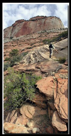
Geology changes dramatically along the eleven-miles from the east entrance of Zion National Park to the south side and again along the six-miles through Zion Canyon. Zion's Tunnels - On the 4th of July, 1930, in a dedication, the completion of the Zion-Mt. Carmel Tunnel was celebrated. This 1.1 mile-long hole through the mountain cost around 2-million dollars and allowed easy access to the east side of Zion. Previously people had to travel a hazardous stretch of mountain road running through the Arizona strip. The new road shortened the distance from Zion to Bryce Canyon by seventy-miles. The tunnel is located between the Canyon Overlook Trailhead and the Switchbacks. It divides the park with the red colored rock on one side and the patterned white slick rock on the other. The other tunnel, located east of the larger, is so short that the opposite end is seen as soon as entering.
Pine Creek - The popular one-mile Canyon Overlook Trail begins at the east side of the Zion-Mt. Carmel Tunnel. It ends at an incredible view of lower Zion Canyon. The easy path climbs above the tunnel, leading hikers past hoodoos and a moist rock alcove with hanging gardens. The trail ends in a nest of stones high above the canyon floor. Looking down over the fenced edge offers a stunning view of the canyon floor and the switchbacks as they wind up toward the tunnel.
Zion National Park, UtahHistory of the Thunderbird |
East Zion Lodge Mileage from Stay in a hotel the heart of the parks, Mount Carmel Junction, and visit the treasures of the Southwest and Utah. Site Map Zion Hiking
|
|||||||||||||
|
This is my new favorite quote:
"I don't know who Mary Cisneros is, but I mean zionnational-park.com It's a better site than the NPS's anyway." Written by the authors of the book: Favorite Hikes in and around Zion National Park |
||||||||||||||
|
Zion History |
|---|
All rights reserved © Copyright Zion National-Park dot com
Do not use text, photos or maps without permission © Zion National-Park dot com
Contact the Author Mary Cisneros with any errors

 Zion's Switchbacks - The winding road that doubles back on itself takes traffic from the intersection of the


