 |
||||
|
Grand Canyon North Rim Toroweap Vacation Hike Backpack Rim2Rim Hwy-67 Photos Weather |
||||
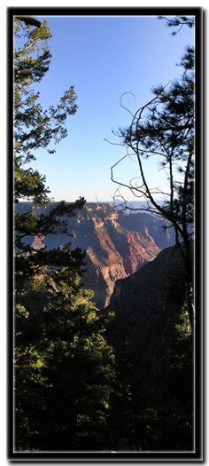
Uncle Jim TrailMany think that when the Grand Canyon Lodge closes its doors in mid-October, entry to the North Rim is halted. The truth is that this is the best time to visit the park if you enjoy the national parks but want to escape the crowds. Highway 67, the road to the North Rim, is under the management of ADOT and they keep the road open until the first heavy snow. This means the road is almost always open in late November and for many years it has been open until mid-December. If going this time of year, be prepared for the high elevation and lack of services. A wonderful trail to take when the temperature dips is the Uncle Jim Trail. This is a moderate hike with a few minor elevation changes. The majority of the trail is located within the wooded areas of the North Rim Plateau, but travel along the rim affords beautiful views of Roaring Springs Canyon and Bright Angel Canyon far below.
Uncle Jim Point - At this point, cables for tethering pack mules and some charming wooden-wheel stools are found beneath soaring Ponderosa Pine trees. Mixed zones of spruce, fir and aspen are seen along the trail at various points. This area is a viewpoint and picnic area shared with pack mule trips operating during the summer months. By continuing farther past this area and onto the prominent point of Kaibab Limestone is Uncle Jim Point . There are impressive views from the point of Roaring Springs Canyon, portions of the Grand Canyon Lodge, Walhalla Plateau as well as Deva, Brahma and Zoroaster Temples. Looking up-canyon to the right, the switchbacks of the North Kaibab Trail can be seen as they descend and skirt the cliff faces far below. Looping - Just back from the point , a trail continues northeast along the rim for a short distance, then ducks into the woods, and then once again continues along the rim. Glimpses of Bright Angel Canyon appear to the east, far below. After about .75 miles the trail leaves the rim and winds its way through the woods then once again arrives at the loop intersection. The path then continues back to the intersection with the Ken Patrick Trail and the .75 mile walk back to the North Kaibab/Ken Patrick parking lot. Overall, this hike is a wonderful reprieve from the busy rim trails located near the lodge. The views are certainly worth the moderate hike through the beautiful forest rimming the north edge of the Grand Canyon. Be on the lookout for the elusive Kaibab squirrel! This unique squirrel is found only in the Ponderosa Pine forests of the North Rim. The Albert squirrel, found on the South Rim and Kaibab squirrel shared the same ancestor, but after separation for thousands of years the Kaibab squirrel developed different characteristics including its bushy white tail.
Uncle Jim Trail GPS Coordinates - WGS84 Datum
Ken Patrick Trail and Uncle Jim Trail Intersection Uncle Jim Loop Trail Intersection Uncle Jim Point Directions to the Grand Canyon North Rim - From Zion National Park, travel SR-9 to Mt. Carmel Jct., then turn south on US-89 to Kanab. There is only one stop light in Kanab; this is where US-89 changes to SR-89A. Fredonia, Arizona is just a few miles away, across the Utah - Arizona border. Take SR-89A to Jacob lake (36 miles), then take SR-67 to the Grand Canyon North Rim park entrance. North Rim Grand Canyon Location - The North Rim of the Grand Canyon is 85 miles from Mount Carmel Junction, which is located on the east side of Zion National Park. Many who visit the National Parks of Southern Utah add the North Rim of the Grand Canyon to their travel plans and those visiting the North Rim of the Grand Canyon often visit Zion National Park.
Grand Canyon North Rim, ArizonaHistory of the Thunderbird |
East Zion Lodge Mileage from Stay in the heart of the parks, Mount Carmel Junction, and visit the treasures of the Southwest and Utah. Site Map Grand Canyon North Rim Grand Canyon Information Ranger Programs North Rim Trails Grand Canyon Maps |
||||||||||||
|
This is my new favorite quote:
"I don't know who Mary Cisneros is, but I mean zionnational-park.com It's a better site than the NPS's anyway." Written by the authors of the book: Favorite Hikes in and around Zion National Park Contact Mary to report errors: |
|||||||||||||
|
Zion History |
|---|
All rights reserved © Copyright Zion National-Park dot com
Do not use text, photos or maps without permission © Zion National-Park dot com
Contact the Author Mary Cisneros


 The trail begins at the North Kaibab/Ken Patrick parking lot located a little more than 2 miles north of the Grand Canyon Lodge. The parking lot is large and is also the beginning point for the North Kaibab Trail that leads to the Colorado River and Phantom Ranch. To begin the hike, locate the sign at the end of the parking lot that indicates the Ken Patrick Trail and provides a brief history of Ken Patrick. Start by walking to the east on the Ken Patrick Trail. The first part of the trail has wonderful rim views. Continue walking on this path until you come to an intersection which is .75 miles into the hike. At the intersection of the Ken Patrick Trail and the Uncle Jim Trail, turn right at the sign, and follow the path downhill. The trail will gradually descend into a wooded wash and then climb out of the hollow to the east. Soon, another intersection is met. Go to the right and continue ascending to the southeast through a gently undulating forest landscape. The trail veers southwest and the rim comes into view.


 Ken Patrick Trailhead