border

Favorite Hikes in and around Zion National ParkCedar Breaks Visitors Center


The Visitor Center opens its doors at the end of May and closes mid-October each year. Look for the daily ranger talks and walks posted at the center. The Zion Natural History Association sells a variety of maps, posters and books at the Cedar Breaks Visitor Center. Kids can pick up their Junior Ranger booklets here and return to report to a ranger when it is completed, to receive their Junior Ranger badge.

Cedar Breaks Ranger programs
The National Park Service (NPS) offers ranger talks and walks throughout the summer. The various programs include geology and evening campfire stories. Sadly, some that visit the Southwest do not visit Cedar Breaks National Monument after they are told that it is simply a "mini Bryce Canyon." That is far from the truth! The only thing the two parks have in common is a nearby location and that the hoodoos and fins appear somewhat similar. Cedar Breaks is an incredible attraction that every vacationer to southern Utah should think about putting on their itinerary.

Cedar Breaks National Park, Utah Coral Pink Sand Dunes Map Grand Staircase-Escalante Map Bryce Canyon National Park Grand Canyon National Park, Arizona - North Rim Map Red Canyon, Dixie National Forest, Utah Lodging: Zion National Park Zion National Park Cedar Breks National Monument, Utah Dixie National Forest: Cedar Mountain Zion National Park Map Coral Pink Sand Dunes Map Zion National Park Lodging Cedar Breaks and Dixie National Forest Map Bryce Canyon and Red Canyon Map Grand Staircase-Escalante Map Zion National Park Map Coral Pink Sand Dunes Map Zion National Park Lodging Cedar Breaks and Dixie National Forest Map Grand Staircase-Escalante Map Bryce Canyon National Park Zion National Park Map Coral Pink Sand Dunes Map Zion National Park Lodging Cedar Breaks and Dixie National Forest Map Bryce Canyon and Red Canyon Map Grand Staircase-Escalante Map Zion National Park Map Coral Pink Sand Dunes Map Zion National Park Lodging Cedar Breaks and Dixie National Forest Map Bryce Canyon and Red Canyon Map Grand Staircase-Escalante Map Zion National Park Map Coral Pink Sand Dunes Map Zion National Park Lodging Cedar Breaks and Dixie National Forest Map Bryce Canyon and Red Canyon Map Grand Staircase-Escalante Map Coral Pink Sand Dunes Map Grand Staircase-Escalante Map Bryce Canyon National Park Grand Canyon National Park, Arizona - North Rim Map Red Canyon, Dixie National Forest, Utah Lodging: Zion National Park Zion National Park Cedar Breks National Monument, Utah Dixie National Forest: Cedar Mountain Zion National Park Map Coral Pink Sand Dunes Map Zion National Park Lodging Cedar Breaks and Dixie National Forest Map Bryce Canyon and Red Canyon Map Grand Staircase-Escalante Map Zion National Park Map Coral Pink Sand Dunes Map Zion National Park Lodging Cedar Breaks and Dixie National Forest Map Grand Staircase-Escalante Map Bryce Canyon National Park Zion National Park Map Coral Pink Sand Dunes Map Zion National Park Lodging Cedar Breaks and Dixie National Forest Map Bryce Canyon and Red Canyon Map Grand Staircase-Escalante Map Zion National Park Map Coral Pink Sand Dunes Map Zion National Park Lodging Cedar Breaks and Dixie National Forest Map Bryce Canyon and Red Canyon Map Grand Staircase-Escalante Map Zion National Park Map Coral Pink Sand Dunes Map Zion National Park Lodging Cedar Breaks and Dixie National Forest Map Bryce Canyon and Red Canyon Map Grand Staircase-Escalante Map Zion National Park Map Coral Pink Sand Dunes Map Zion National Park Lodging Cedar Breaks and Dixie National Forest Map Bryce Canyon and Red Canyon Map Grand Staircase-Escalante Map Biking in Cedar Breaks
Bikes are allowed on the highways and on some of the Dixie National Forest trails. Blowhard, an advanced technical bike trail, starts near Cedar Breaks and gives impressive views of the area. Brian Head Ski Resort has some mountain bike trails. Navajo Lake Loop and the Virgin River Rim bike trails in Dixie National Forest are popular.

Point Supreme Campground
The campground is open from mid-June through September. The twenty-eight sites are given on a first come first use basis. Expect nighttime summer temperatures to reach as low as 30 degrees at Cedar Breaks. The campground is equipped with water, tables, fire grills and restrooms. There is an amphitheater where the rangers hold seasonal campfire programs. For those with a Golden Age or Golden Access cards the camping fee is $6. There are other camp sites offered in Dixie National Forest

Directions to Cedar Breaks

U-148 Closure Dates. U-148 to Cedar Breaks closes in the winter due to snow depth.

From Las Vegas: Take I-15 north to Cedar City. Take U-14 east from Cedar City to U-148 and turn left to Cedar Breaks.
From Arizona: Take US-89 north through Mount Carmel Junction and turn west on U-14. Turn right at U-148 to Cedar Breaks.
From Salt Lake City: Take I-15 south, exit at Parowan. Take U-143 to Cedar Breaks.
From Mount Carmel Junction: Take US-89 north to U-14. Follow U-14 to U-148 and Cedar Breaks.

Cedar Breaks Road Map - Cedar Mountain Map

Zion National Park Maps Map: Cedar Mountain - Dixie National Forest Southern Utah map Zion National Park Map - Overview of Zion Utah State Road 14 Utah State Road 148
 
Cedar Breaks National Monument

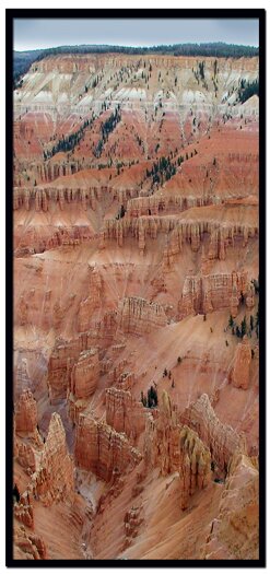
The Cedar Breaks amphitheater is three miles of impossible shaped rocks, situated at 10,000' on the Markagunt Plateau. The first automobile to manage it's way to the breaks was in 1919.


Lodging Zion National Park
Lodging Zion National ParkLodging and services are available on the gorgeous east side of Zion National Park, where guests are close to Zion National Park (12 miles), Bryce Canyon National Park (60 miles), Cedar Breaks National Monument (45 miles), Coral Pink Sand Dunes (12 miles), and the North Rim of the Grand Canyon (85 miles). It's where city traffic is absent and the skies are bright and clean.


Cedar Breaks Lodging - There is lodging at Duck Creek or on the east side of Zion National Park. The Best Western East Zion Thunderbird Lodge, East Zion Rental House and the East Zion Riverside Campground are located at the perfect spot for your vacation in southern Utah. Enjoy Utah's scenic byways, returning to the junction of Scenic Byway 9 and Scenic Byway 89, which meet at the alluring mountains of Mount Carmel Junction.

Utah's Dixie National Forest: Cedar Mountain
Cedar Breaks National Monument is surrounded by Utah's Dixie National Forest. From Mt. Carmel Junction, drive north on US-89 to the junction with SR-14. SR-14 is known as Cedar Mountain which is the scenic byway to travel to Cedar Breaks. Once on Cedar Mountain, travel through the beautiful forest, and then turn at the signed highway to Cedar Breaks - SR-148. It's 22 miles from Mt. Carmel Junction to boundary of Dixie National Forest and 45 miles to Cedar Breaks.

Utah's Dixie National Forest: Red Canyon
Red Canyon is a unique part of Dixie National Forest that is not only traveled through on the way to Bryce Canyon, but it has eroded hoodoos like Bryce Canyon and Cedar Breaks. It is found along Scenic Byway 12.


Web Southwest Parks


Share

Cedar Breaks National Monument, Utah

Best Western
East Zion Lodge

Reservations
1.888.848.6358

Zion Park Lodging

Zion National Park Lodging

East Zion Lodge
Vacation House
Group Lodging
East Zion Golf
East Zion RV Park
Vacation Packages
Business Retreat

Mileage from
Mt. Carmel Jct.

Zion National Park 12
Bryce Canyon 60
Grand Canyon 85
Cedar Breaks 45
Grand Staircase 9
Dixie Forest 22
Sand Dunes 11
Coyote Butte 57
Red Canyon 47
Tuweep 90

Stay in the heart of the parks, Mount Carmel Junction, and visit the treasures of the Southwest and Utah.

Site Map
Site Map II
Site Map III


Hiking Trails
Bartizan Arch
Spectra Point Trail
Ramparts Trail

Easy Trails
Cascade Falls
Bristlecone Pine
Alpine Pond

Cedar Breaks info
Visitor Center
Fees and passes
Ranger programs
Kid activities
History
Fauna
Flora

Cedar Breaks maps

Park map
Road map

This is my new favorite quote:
"I don't know who Mary Cisneros is, but I mean zionnational-park.com
It's a better site than the NPS's anyway."
Written by the authors of the book: Favorite Hikes in and around Zion National Park
Contact Mary to report errors:
 
border

Zion History
Zion Landmarks
Zion Geology
Zion Geology II
Zion Geology III
Zion Fauna

Zion Rock Art

Disclaimer & Privacy Policy
All rights reserved © Copyright Zion National-Park  dot com
Do not use text, photos or maps without permission © Zion National-Park dot com
Contact the Author Mary Cisneros
Bryce Canyon Map Zion National Park Map - Overview of Zion