 |
||||
|
Cedar Mountain Red Canyon Cedar Breaks Camping SR 148 SR-14 Hike Backpack Vacation Pictures |
||||
|
|||||||||||||
|
Utah's Dixie National Forest: Cedar Mountain Cedar Breaks Road Map - Cedar Mountain Map 
|

|
|||
|
|
||||
Scientists had long considered the Bristlecone to be the oldest living thing, however, recent ideas on the subject have some researchers including vegetation that sprouts from roots such as groves of Aspen, creosote and huckleberry and perhaps other plants that form clonal colonies. Under this new definition they make even the oldest of all known Bristlecone's seem like youngsters, but i t is all about how it is defined. If you are talking about a single trunk or stem, then the Bristlecone is indeed the oldest single living organism.
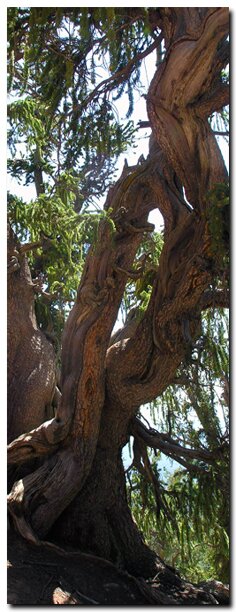
 Although the Bristlecone along this trail are not the oldest in the world, they have been dated to being up to 4,500 years old. These trees have adapted to living on barren slopes and cliff s. If unsure which are the ancient pines, look for needles in groups of five. The leaves will be one inch to one and half inches long. They have a thin, smooth bark, which is grayish white on young stems. As the stems age, the color becomes a reddish brown and the trunks begin to twist. The cone is tipped with long bristle seeds. A lush sub-alpine forest of quaking aspens surrounds this tranquil place, high on the mountain where the pine shows off its twisted ancient bark.
GPS Coordinates WGS84 Datum
Bristlecone Pine Trailhead:
37 34.043 N
112 50.951 W
Bristlecone Pine Trailend
37 33.890 N
112 51.053 W
GPS coordinates are only references and may or may not be accurate. Do not rely on GPS coordinates as the sole method of navigation. Always have an accurate, detailed map at hand and have the proper map reading and navigation skills before setting out on any hike. Many of the hikes listed in this guide travel into canyons where a GPS has limited capabilities. Always check your position with a detailed map before dropping into a canyon.
|
|
Dixie National Forest, Utah
Cedar Mountain and Red Canyon
East Zion Lodge
Vacation House
Group Lodging
East Zion Golf
East Zion RV Park
Vacation Packages
Family Reunion
Bus Tours
Business Retreat
Mileage from
Mt. Carmel Jct.
Zion National Park 12
Bryce Canyon 60
Grand Canyon 85
Cedar Breaks 45
Grand Staircase 9
Dixie Forest 22
Sand Dunes 11
Coyote Butte 57
Red Canyon 47
Tuweep 90
Stay in the heart of the parks, Mount Carmel Junction, and visit the treasures of the Southwest and Utah.
Site Map
Site Map II
Site Map III
Hiking Trails
Bartizan Arch
Spectra Point Trail
Ramparts Trail
Below the Rim
Virgin River Rim
Ashdown Gorge
Easy Trails
Cascade Falls
Bristlecone Pine
Alpine Pond
Dixie National Forest
Ranger programs
Kid's activities
Caving, fishing, hunt History
Flora
Fauna
"I don't know who Mary Cisneros is, but I mean zionnational-park.com
It's a better site than the NPS's anyway."
Written by the authors of the book: Favorite Hikes in and around Zion National Park
Contact Mary to report errors:
|
Zion History |
|---|
All rights reserved © Copyright Zion National-Park dot com
Do not use text, photos or maps without permission © Zion National-Park dot com
Contact the Author Mary Cisneros

 Bristlecone Pine Trail


