Moquith Mountain, Harris Mountains
& South Fork Indian Canyon Conservation Areas
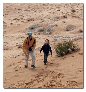
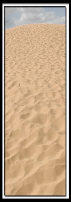
The Coral Pink Sand Dunes State Park keeps 256 acres reserved for non-motorized use but much of the rest of the park is an off-terrain paradise.
South Fork Indian Canyon - South Fork Indian Canyon is located northeast of the Coral Pink Sand Dunes. Incredible Indian pictographs are found in this area. Some are public and others are hidden. To find the trailhead to the public pictographs, travel four miles northeast of the dunes. Two unnamed canyons can be found at the Southfork of Indian Canyon along with a host of vegetation and wildlife. The scenery along the South Fork Indian Canyon Pictograph Trail is as amazing as the pictographs at the end of the trail.
Harris Mountains - The Harris Mountains are located in the Parunuweap Canyon wilderness study area. An overlook at the top of the Harris Mountains, just north of Coral Pink, offers spectacular views. The East Fork of the Virgin River runs westward through Parunuweap Canyon and into Zion National Park.
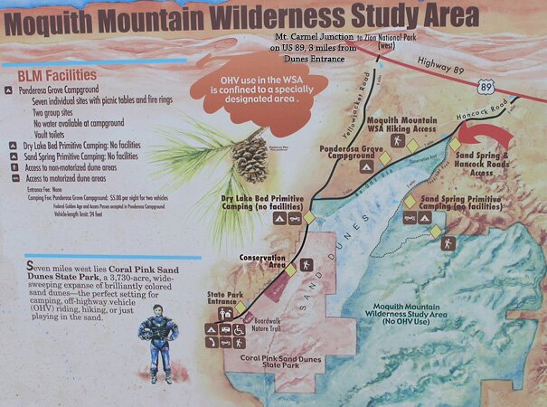
Moquith Mountain - Kanab Canyon and the Grand Canyon North Rim are on the east side of the Coral Pink Sand Dunes State Park. These sites can be viewed, at a distance, from the Moquith Mountains. The Moquith Mountains and Moccasin Mountains are on the south side of the Coral Pink Sand Dunes. The Moquith Mountains make up 26,500 acres of remote Southern Utah land. Beside dunes of sand, Vermillion Cliffs, finger-like canyons and perennial streams decorate the land. The South Fork Indian Canyon pictograph trail is part of this area. Backpackers will find solitude and beauty without venturing too deep. Canyoneers exploring South Fork Indian Creek-Water Canyon will see beautiful hanging gardens and pristine beauty. Destinations include backpacking to the top of the 7000' Moquith Mountain. The Sand Dunes are spectacular from the Moquith Mountain plateau. Stay on existing trails if visiting this area. Much of the land is designated as a BLM wilderness study area.
Directions to the Coral Pink Sand Dunes State Park Plan your Coral Pink Sand Dunes Vacation with our
Utah Maps and Information
Coral Pink Sand Dunes from Zion National Park
From Zion National Park. Exit Zion Park through the east entrance and drive 12 miles to the junction U-9 & US-89. This is Mount Carmel Junction. Turn south on US-89. Turn-off to the sand dunes 3 miles from Mt. Carmel Junction. Follow Yellow Jacket road for 8 miles to the Coral Pink Sand Dunes State Park. Lodging for Coral Pink Sand Dunes
Coral Pink Sand Dunes from
Utah Highway 59 & Arizona 389
From Hurricane, Utah take Utah 59 to Arizona 389 just past Colorado City look for the road leading to the Coral Pink Sand Dunes. It will come out 3 miles from Mt. Carmel Junction, Utah. Do not travel through the dunes when it's been raining or the roads are wet from snow.
Coral Pink Sand Dunes through Fredonia, Arizona
From Hurricane, Utah take Utah 59 to Arizona 389 and travel to Fredonia, Arizona, then to Kanab, Utah. Drive on US Highway toward Mt. Carmel Junction, turning at the signed entranced to the Coral Pink Sand Dunes.
Coral Pink Sand Dunes
Lodging and services are available on the gorgeous east side of Zion National Park, where guests are close to Zion National Park (12 miles), Bryce Canyon National Park (60 miles), Cedar Breaks National Monument (45 miles), Coral Pink Sand Dunes (12 miles), and the North Rim of the Grand Canyon (85 miles). It's where city traffic is absent and the skies are bright and clean.
Mileage from
Mt. Carmel Jct.
Zion National Park 12
Bryce Canyon 60
Grand Canyon 85
Cedar Breaks 45
Grand Staircase 9
Dixie Forest 22
Sand Dunes 11
Coyote Butte 57
Red Canyon 47
Tuweep 90
Stay in the heart of the parks, Mount Carmel Junction, and visit the treasures of the Southwest and Utah.
This is my new favorite quote:
"I don't know who Mary Cisneros is, but I mean zionnational-park.com
It's a better site than the NPS's anyway."
Written by the authors of the book: Favorite Hikes in and around Zion National Park