 |
||||
|
Cedar Mountain Red Canyon Cedar Breaks Camping SR 148 SR-14 Hike Backpack Vacation Pictures |
||||
Backpacking Dixie National Forest
There is the Duck Creek Visitor Center by Duck Creek and Navajo Lake
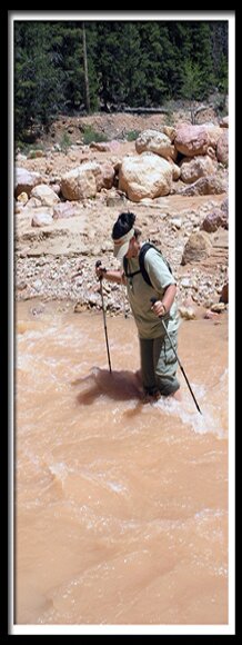
This is a 10 mile hike. The time it take to hike depends on the water levels and how many side canyons you explore. Plan on 6 hours to a full day of hiking. With so much to see and explore the hike is often stretched out to a 2 or 3 day backpack. The hike is one way and two cars are needed or hitchhike back to your vehicle. Cedar Breaks Bottoms - This route takes backpackers to the bottom of the impressive Cedar Breaks hoodoos and allows wilderness camping. From Cedar Breaks National Monument, there is no way to hike to the bottom where the hoodoos are, but this route through Dixie National Forest allows access to then. If a car shuttle is used then it's a one way hike of mostly downhill hiking.
Utah's Dixie National Forest: Cedar Mountain Red Canyon is a unique part of Dixie National Forest that is not only traveled through on the way to Bryce Canyon, but it has eroded hoodoos like Bryce Canyon and Cedar Breaks. It is found along Scenic Byway 12
Dixie National Forest, Utah
|
East Zion Lodge Mileage from Stay in the heart of the parks, Mount Carmel Junction, and visit the treasures of the Southwest and Utah. Site Map
Easy Trails Dixie National Forest |
||||||||||||||
|
This is my new favorite quote:
"I don't know who Mary Cisneros is, but I mean zionnational-park.com It's a better site than the NPS's anyway." Written by the authors of the book: Favorite Hikes in and around Zion National Park Contact Mary to report errors: |
|||||||||||||||
|
Zion History |
|---|
All rights reserved © Copyright Zion National-Park dot com
Do not use text, photos or maps without permission © Zion National-Park dot com
Contact the Author Mary Cisneros


