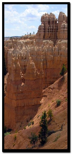
Bryce Canyon is an out-of-the-ordinary landscape, providing outstanding photo opportunities. Nature's geography is exposed for the photographer in Bryce, where hoodoos stand in vivid display as visitors walk around the rim and drive to scenic view points. Bryce Canyon View Points
Bryce Canyon Hiking Pictures
Spectacular hikes in Bryce Canyon lead to outstanding photo sites for photography. Magnificent, twisted sandstone towers, vistas and buttes are at every turn. Erosion in Bryce has changed fins to windows to hoodoos making up fairyland castles to wander through.
Photography in Bryce Canyon
Bryce Canyon is as photogenic as it gets. There may not be waterfalls galore, or high towering monoliths, but Bryce has a special magic all its own. It it the top riser of the Grand Staircase geology, which is a layer that is cut, broken and rapidly eroding. This moves tattered sandstone quickly to a form that resembles sculptured statures, which are commonly called hoodoos. The hoodoos stand at attention through a vast valley that connects and showcase their beauty for all visitors to see and capture on film. Nearby is Dixie National Forest's Red Canyon. This small section of the National Forest is also a part of the top riser of the Grand Staircase, along with Cedar Breaks and broken areas along scenic SR-14- a highway the locals call Cedar Mountain. It travels 40 miles from US-89 to Cedar City, Utah. There are sections of hoodoos that can be seen along the Virgin River Rim Trail.
Directions to Bryce Canyon
From Salt Lake City: Travel south on Interstate 15 past Beaver to UT 20. Exit on UT 20. Turn south on UT 89 and travel past Panguitch. Follow UT 89 to UT 12. Travel along UT 12 through Red Canyon to Bryce Canyon. Turn south on UT 63 to enter the park. From Las Vegas: Travel Interstate 15 past St. George to Exit 16. Drive through Hurricane, Utah. Follow Utah Highway 9 through Hurricane and to the only stop light in LaVerkin. Turn right at the stop light. Continue on Highway 9 to the south entrance of Zion National Park. Drive through Zion to the junction of UT 9 and US 89 at Mt. Carmel Jct. Turn north on UT 89, then exit on UT 12. Follow UT 12 through Red Canyon, turning south on UT 63 to enter Bryce Canyon.
The hoodoos as seen here, along the Fairyland Trail are typical of most of the hoodoos in the park. Bryce Canyon is a magical place where hoodoos become all too commonplace and they take their place as the top rise of the grand staircase geological formation.
Lodging and services are available on the gorgeous east side of Zion National Park, where guests are close to Zion National Park (12 miles), Bryce Canyon National Park (60 miles), Cedar Breaks National Monument (45 miles), Coral Pink Sand Dunes (12 miles), and the North Rim of the Grand Canyon (85 miles). It's where city traffic is absent and the skies are bright and clean.
Mileage from
Mt. Carmel Jct.
Zion National Park 12
Bryce Canyon 60
Grand Canyon 85
Cedar Breaks 45
Grand Staircase 9
Dixie Forest 22
Sand Dunes 11
Coyote Butte 57
Red Canyon 47
Tuweep 90
Stay in the heart of the parks, Mount Carmel Junction, and visit the treasures of the Southwest and Utah.
This is my new favorite quote:
"I don't know who Mary Cisneros is, but I mean zionnational-park.com
It's a better site than the NPS's anyway."
Written by the authors of the book: Favorite Hikes in and around Zion National Park
Contact Mary to report errors: