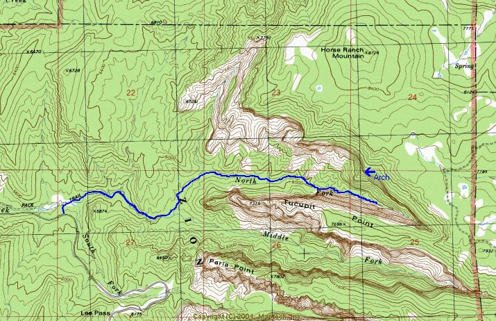
North Fork Taylor Creek Map
North Fork Taylor Creek Trail DescriptionZion National Park Pictures
Previous | North Fork Taylor Creek photos | Next
Kolob Canyons Map: North Fork of Taylor Creek route. The route begins at the heavily traveled Middle Taylor Creek Trail and turns off at the confluence with the North Fork. The route is a 4 mile, unmaintained trail, leading into the canyon between Horse Ranch Mountain and Tucupit Point. The finger-like Kolob Canyons have sheer 1500'/ 457m walls. Along the hike there is a natural arch, Pico Rosado, high up on the cliff. Horse Ranch Mountain is the highest point in Zion National Park at 8726 '/2660m.
Arch: Pico Rosado (Pink Spire)
GPS: UTM
12 308482E
4148415N
Mileage: 2.5 miles - Confluence of 3rd tributary and the North Fork of Taylor Creek. The first view of the Pico Rosado Arch is a side view from the creek bed. Further down the North Fork it is easier to see the arch from the shoulder on the south side of the creek.
